Loading

Logo
  • Home
  • About Us
  • Our Services
  • Technology
  • Contact

Technology

Home - Technology

Combined high-density survey sensors acquisition (Sonar & LiDAR)

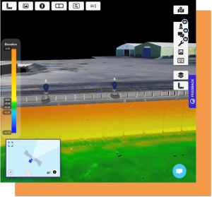
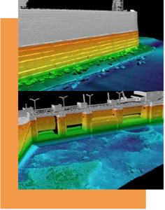
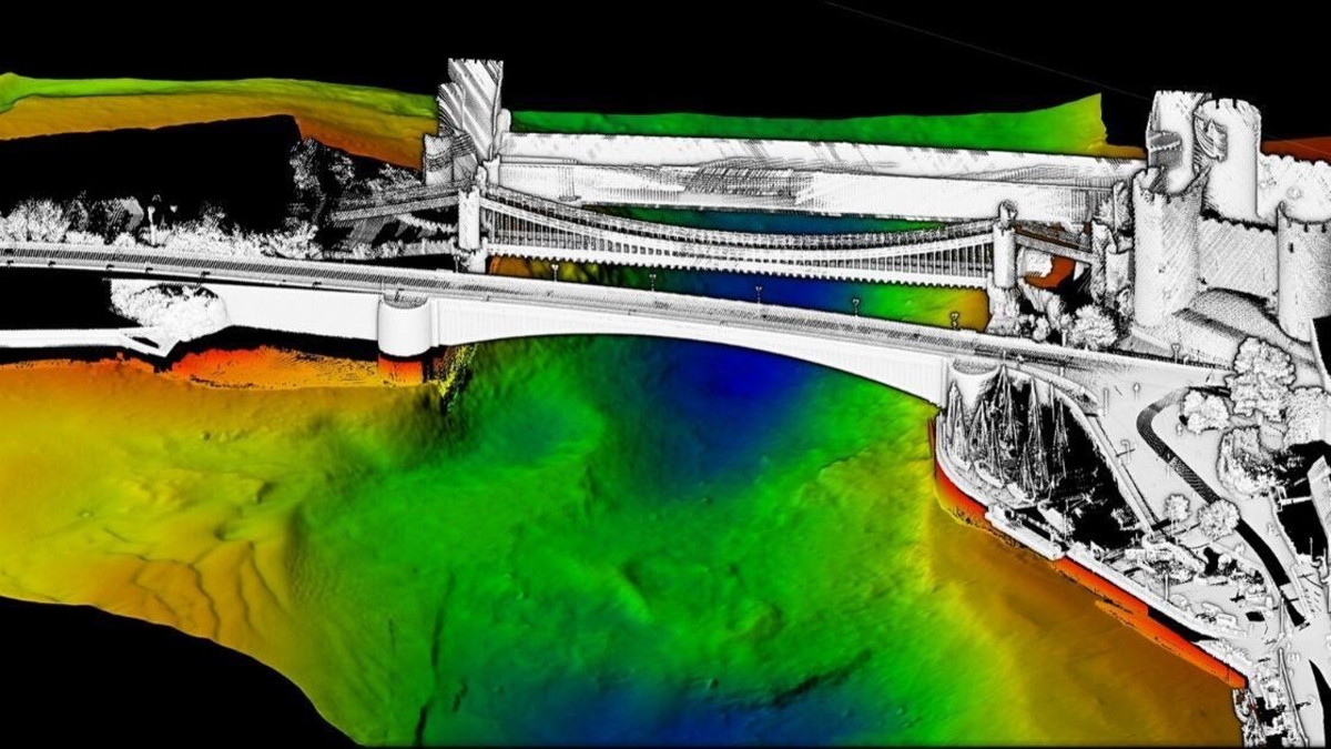
LYUMARINE implements a combined simultaneous high-specification survey sensors acquisition to obtain a high density seamless coverage dataset for the structural integrity monitoring. We merge marine and terrestrial survey techniques – multibeam echosounder and 3D scanning LiDAR deployed on a sea surface platform complemented with the airborne high-resolution stereophotogrammetric and LiDAR inspection.
Combined high-density survey sensors acquisition

The goal of the combined sensors acquisition implementation is to provide a 3D perspective of coastal assets, a so called “digital twin” offering a cost-effective substitute for traditional methods of inspection and monitoring.

The point cloud based 3D technologies open up great opportunities for the asset owners:

  • Timely and cost-effective monitoring of the actual condition of structures (both above-water and subsea parts), including the control of the foundation scouring – the most common cause of the nearshore infrastructure damage and shutdowns
  • Significant reduction or even complete elimination of the need for diving operations
  • Accurate 3D measurements based assessment of the required repair material and the maintenance efforts
  • Simplified interaction of all stake holder enabled by the use of cloud services and an intuitive interface allowing to take the best out of the 3D representation of the assets
 

Combined high-density survey sensors acquisition

Unmanned autonomous marine survey platforms

Unmanned autonomous marine survey platforms


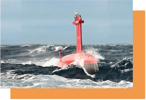
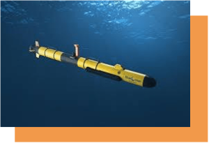
With firm believe in the marine acquisition and subsea operations industry being on the brink of a profound transformation due to emerging USV and AUV technologies LYUMARINE intends to lead the way utilizing the dynamic platforms extending the capabilities of traditional survey equipment and opening the new opportunities for our clients delivering our services more cost-efficiently and safer than ever.


Unmanned autonomous marine survey platforms


Application of the unmanned survey platforms allows us to conduct surveys at least 30% faster than traditional survey vessels, 400% faster than small survey launches, and 800% faster than traditional tethered ROV systems. Marine unmanned technologies are designed to drastically reduce the fuel consumption, as well as the number of technical fleet units and engineering personnel involved in execution of the offshore project immediately resulting in unparalleled mitigation of the survey missions environmental impact whilst increasing productivity and gathered data quality.


Offshore subsea positioning solutions

Offshore subsea positioning solutions


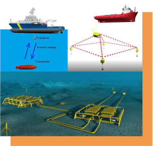
The accuracy requirements of the underwater positioning is directly determined by the type of work performed thus influencing the choice of underwater navigation and positioning technology.

Subsea positioning techniques applied by LYUMARINE are based on the use of acoustic and inertial navigation systems including the fast deployment of the LBL and sparse LBL networks enabling the centimeter level of underwater positioning of objects and carried out measurements (subsea metrology tasks).

IT Infrastructure for Online Asset Data Management

IT Infrastructure for Online Asset Data Management

An asset, such as bridge, port terminal, energy’s sector facility, contains a huge amount of information, which is used daily to run and optimize the operations.

Presently, the many various traditional systems of collecting and storing the information on the asset structural integrity and its operational capacity are not merged together into a single monitoring and management process but rather represent segmentary reports residing on different platforms and in different formats.

The   goal  of      the    Online       Asset Data Management     System implementation is to resolve that problem by       offering an integrated cloud based data bank for all the asset related information with easy access for a vast audience of stakeholders intended to result in improved efficiency, safety, ecological footprint, and the extended life cycle of the asset!

IT Infrastructure for Online Asset Data Management


Application of the 3D data representation.

Each asset is stored as an individual profile in the cloud server database. Where the physical structure is being transformed into a “digital twin” characterized by an easy-to-understand georeferenced 3D visual model and complemented with the user addable layers of the annotations and metadata content incorporating the information derived from both the traditional and the remote sensing inspection techniques: photographs, technical reports or CAD drawings.

The asset data is made available for all, anywhere, and at anytime… to view, analyze and utilize it despite of a professional background or software available, since all you need is just a web browser.


IT Infrastructure for Online Asset Data Management

High Level of Cyber Security and Data Exchange Speed

Apart from the unique software component, the Online Asset Data Management System architecture also involves a secure and broad band networking infrastructure linking together the datacenter with all the heavy computing and storage capacity and the user end of the solution.

Application of the AI in order to improve the asset management process

The Asset Management Digital Platform would take advantage of the most advanced computer science solutions in order to structurize and categorize a huge bulk of data followed by deep analysis and processing of the obtained information applying specially designed algorithms based on the Big Data, Machine Learning, and AI technologies.

Footer Logo

Copyright Lyumarine 2022. All Rights Reserverd.

GO TO TOP